AIGIS Field
iOS and AndroidReport from the response
Share location and unit status, see nearby operational context, and keep the active mission available on the device responders already carry.
Field shares unit location and status. OPS combines that data with missions and configured weather, fire, outage, and aircraft layers.
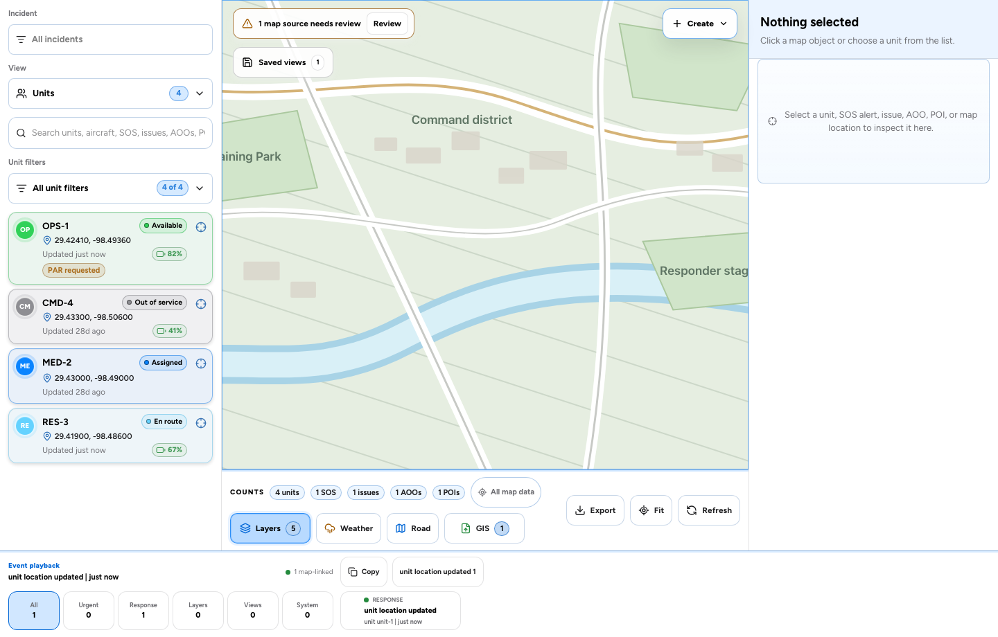
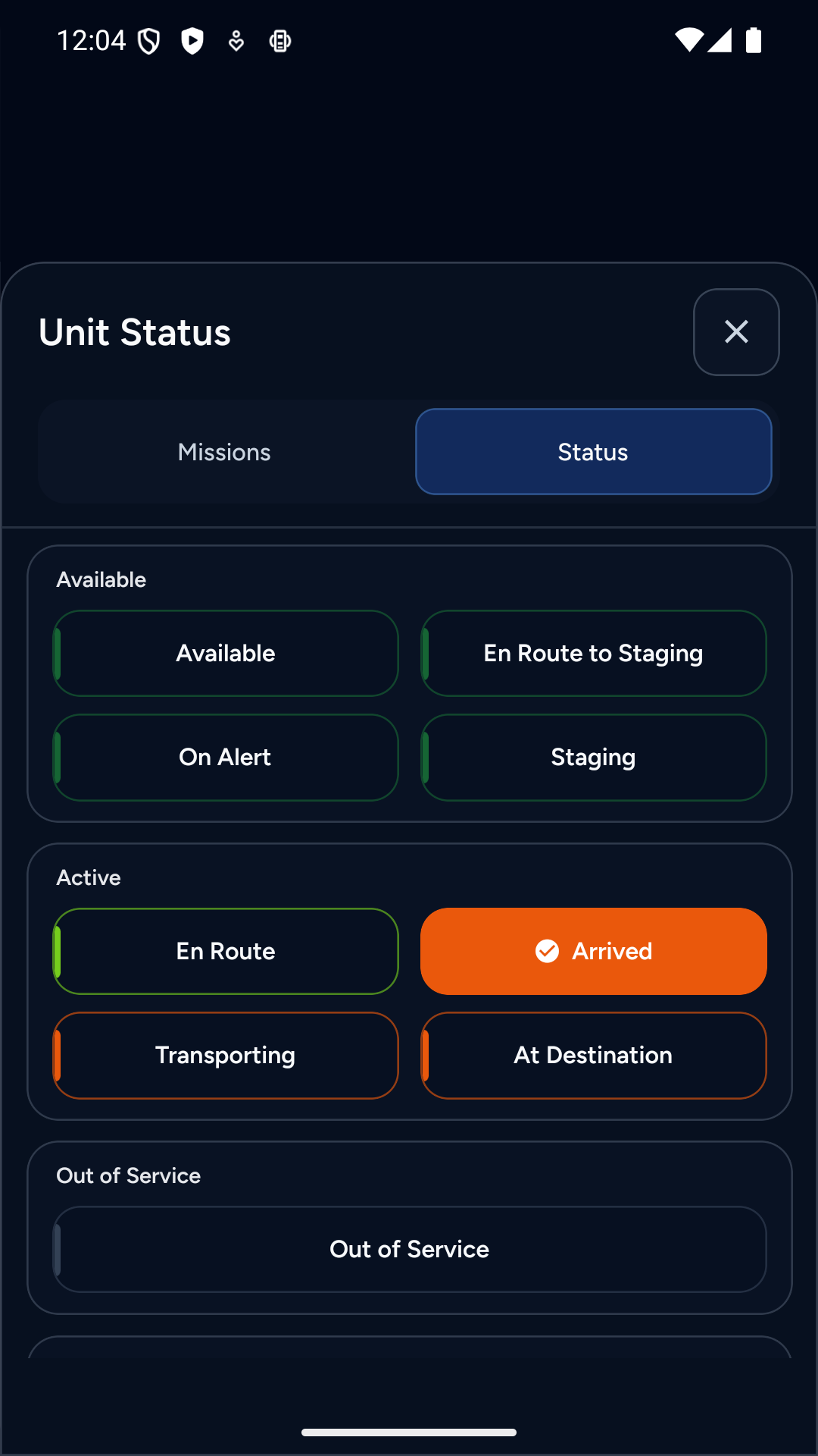
Representative data shown in the implemented AIGIS Field and AIGIS OPS interfaces. No production unit or responder records are pictured.
AIGIS Field
iOS and AndroidShare location and unit status, see nearby operational context, and keep the active mission available on the device responders already carry.
AIGIS OPS
macOS and WindowsMonitor more units at once, filter by incident and operational state, inspect map objects, and take permitted actions without leaving the map.
See where a unit last reported, whether it is moving, what work defines its current state, and which action an authorized operator can take next.
Connected-device fields vary by source. When supplied, AIGIS can also display reported fuel, battery voltage, engine RPM, VIN, GPS solution, firmware, and device configuration.
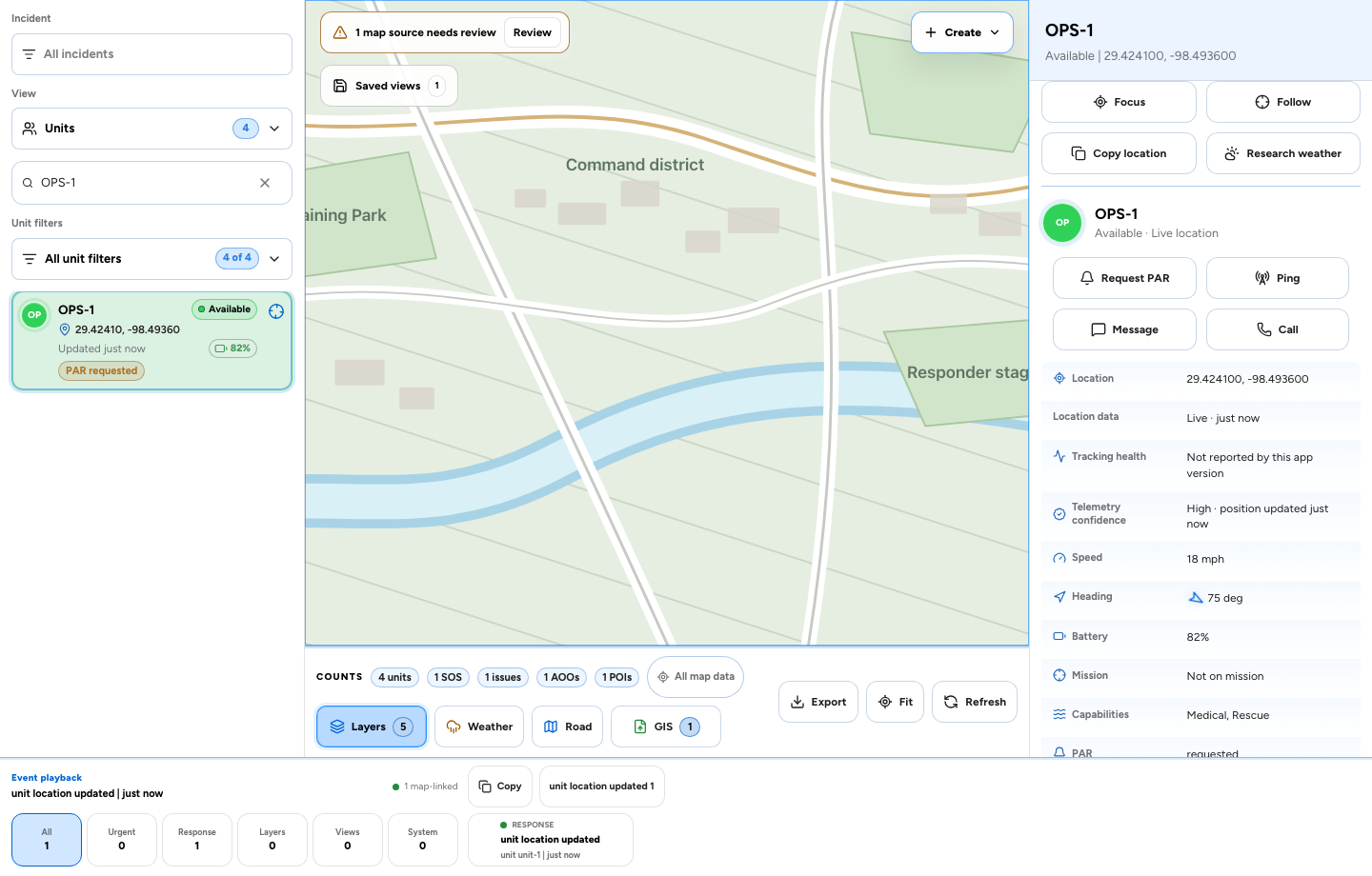
Fictional unit data in the implemented OPS unit-inspection workflow. Actions remain permission- and connectivity-dependent.
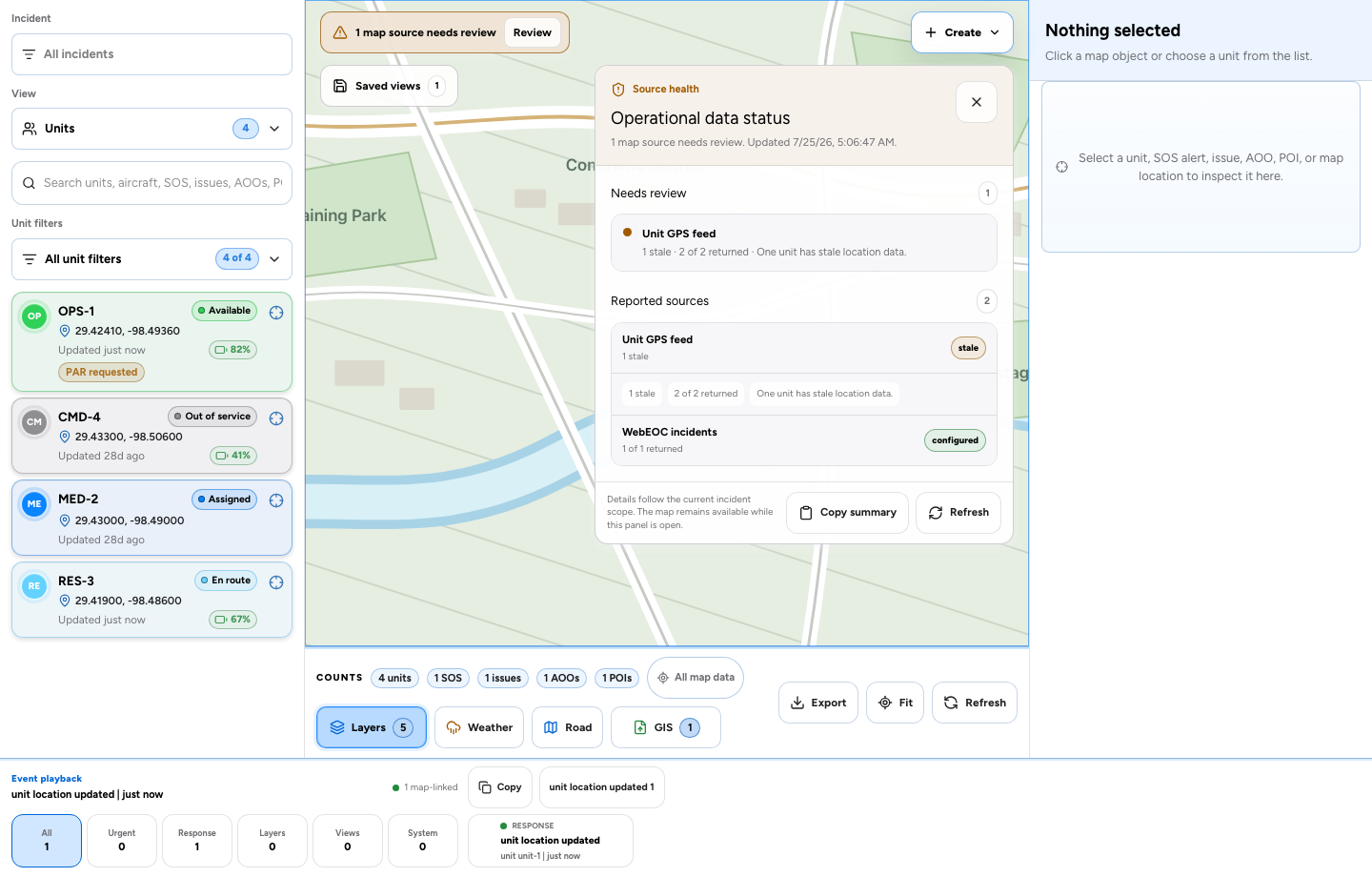
Representative degraded-source state using fictional data.
AIGIS exposes location age, source timestamps, refresh state, and degraded or unavailable inputs so operators can distinguish current information from context that needs verification.
Place the conditions affecting the response over the same map used to understand units and missions, then return to a clear operating picture.
Radar, public alerts, storm cells, convective conditions, lightning, wind, flooding, heat, air quality, and tropical systems.
Observed fire activity, fire-weather alerts, dry-lightning risk, and outlook information beside the resources that may be affected.
Power-outage conditions in the same operational frame as units, facilities, access routes, and community needs.
Aircraft position, track, classification, altitude, groundspeed, heading, squawk, flight details, and temporary flight restrictions when available.
Areas of operation, points of interest, issues, SOS events, and imported GIS layers can remain visible beside the external conditions affecting the response. Layer availability depends on configuration, permissions, source coverage, and source health.
Narrow the map by incident, unit freshness, PAR state, capability, mission type, issue priority, or SOS status. Saved views preserve a useful command frame for the next handoff.
Current view
Medical units · Open PAR
Field responders can create and take missions when policy allows. Authorized OPS users can assign units, update status, review routes, and follow the work.
Explore AIGIS DispatchA responder or coordinator identifies work from the field or map.
When incident policy allows, Field responders can create a mission and take it with their active unit.
OPS can assign, update, route, and follow the mission and unit state.
Mission status remains connected to the incident record through completion.

When enabled, AIGIS can assemble a structured weather brief for a selected point or mission using available current conditions, official alerts, lightning, road-weather context, timing signals, and applied risk thresholds.
See the weather research workflowSelected map point
Staging Area North
Structured weather brief
The result can surface identified impacts, timing windows, confidence, assumptions, warnings, and recommended precautions for an operator to evaluate.
Unsafe after
Identified from available signals
Clear by
Recommended timing target
Signals
Official alerts and risk timeline
Confidence
Reported with the research
AI assistance is advisory. Operators remain responsible for source verification, interpretation, and operational decisions. Availability depends on configuration and permissions.
Saved views retain the incident scope, filters, visible counts, active layers, and source-health notes.
Request access for AIGIS Field and AIGIS OPS using your unit types, mission flow, status model, and operational map requirements.